New satellite images reveal scale of Putin’s "flying Chornobyl" test complex
Google Earth has updated its images of Novaya Zemlya, the Arctic archipelago where Russia’s nuclear weapon designers are conducting tests of their latest inventions.

"Nobody has anything like this," Vladimir Putin said in his address to the Federal Assembly in 2018.
The president was bragging about the Burevestnik, a nuclear-powered cruise missile designed to fly low with a nearly unlimited range. It is also said to have mid-air navigation capabilities aimed at evading enemy missile defence systems.
The weapon designers, however, had one big problem. The missile Putin presented in 2018 was premature. It didn't work.
Later the same year, the Barents Observer published the first report about Norwegians being worried about radioactivity from the tests at Novaya Zemlya. The missile's reactor has an open-air cooling system, releasing radioactive material from its exhaust.
The Bellona Foundation, a watchdog group that for decades had been working with nuclear safety in Russia, was soon to name Putin's new missile "a flying Chornobyl."
The test site is at Pankovo on the southern island of the archipelago is less than 900 km from Norway's northeast corner.
Four tests of the missile took place between November 2017 and February 2018. All four crashed soon after launch, according to a U.S. intelligence leak to media. The longest flight lasted just over 2 minutes and over a distance of 35 km.
Pankovo was established in the late 1950s as a secret air test and command post, known as Military Unit 90214. Located about 100 kilometres from the northern test site for atmospheric nuclear bomb detonations, the personnel observed the nuclear clouds and collected samples of radionuclides from the air, according to an online encyclopaedia with eyewitness stories from Novaya Zemlya.
This summer came with record high activity at Pankovo, as previously reported by the Barents Observer. How many missiles have been tested is unknown. It is also undisclosed how many have crashed at sea and whether any have crashed on shore, most likely somewhere near the former test site for atmospheric nuclear bombs north of the Matockhin Strait.
Radiation protection authorities in the Nordic countries have so far not reported any suspicious measurements of isotopes.
However, tests are likely carried out when the wind blows north, or northeast.
The entire Novaya Zemlya is a restricted area, and both the airspace and waters nearby have been closed for civilian aviation and sailing for long periods from July to late September.
Now, Google Earth has updated imagery for the entire west coast of the southern island of Novaya Zemlya. The photos were taken in the period of August 5 to 14.
Both the Pankovo test site and the Rogachevo military air base further south can be studied in detail for the first time from an online non-commercial satellite imagery source.
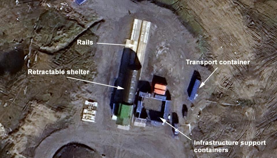
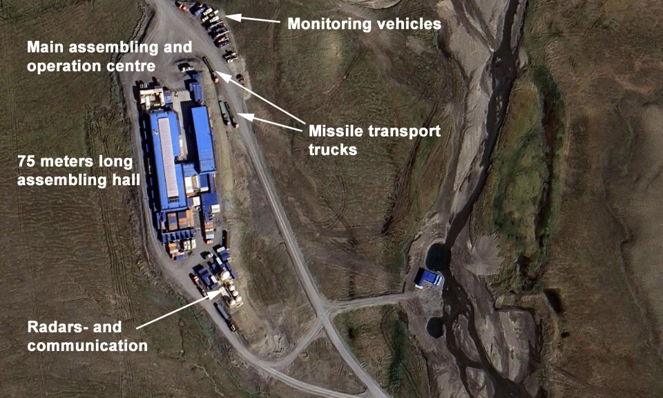
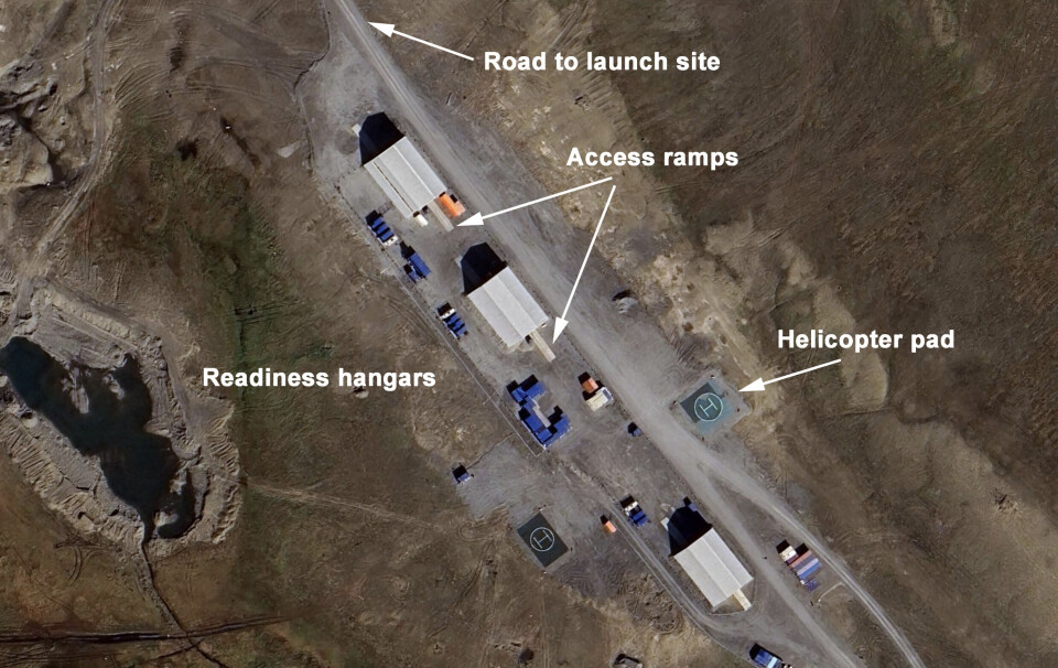
Below you can see an overview image of the area, followed by zoomed-in enlargements of the different sites. A close-up of the actual launch site can be seen in the main image at the top of this article.
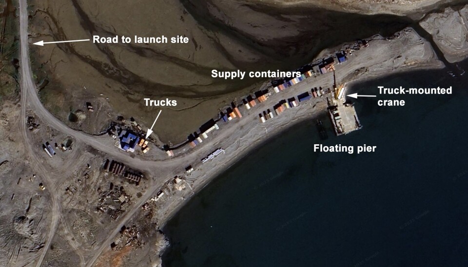
The distance from the pier on the shore to the launch site in the north is about six kilometres.
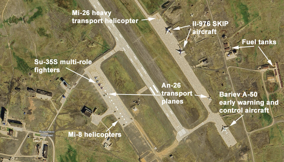
The last image shows the Rogachevo air base, some 170 km south of the Pankovo site.
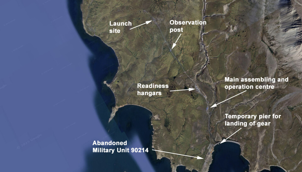
Landing pier and storage site
Main assembling and control post
Readiness hangars
Rogachevo air base